


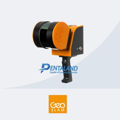

GeoSLAM ZEB Horizon RT 3D mapping Scanner
$26,000
Related Products
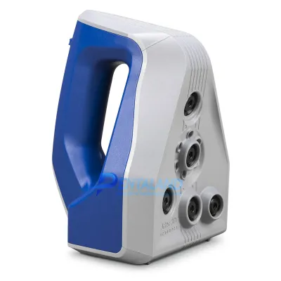
For sale the new GeoSLAM ZEB Horizon RT 3D mobile mapping Scanner
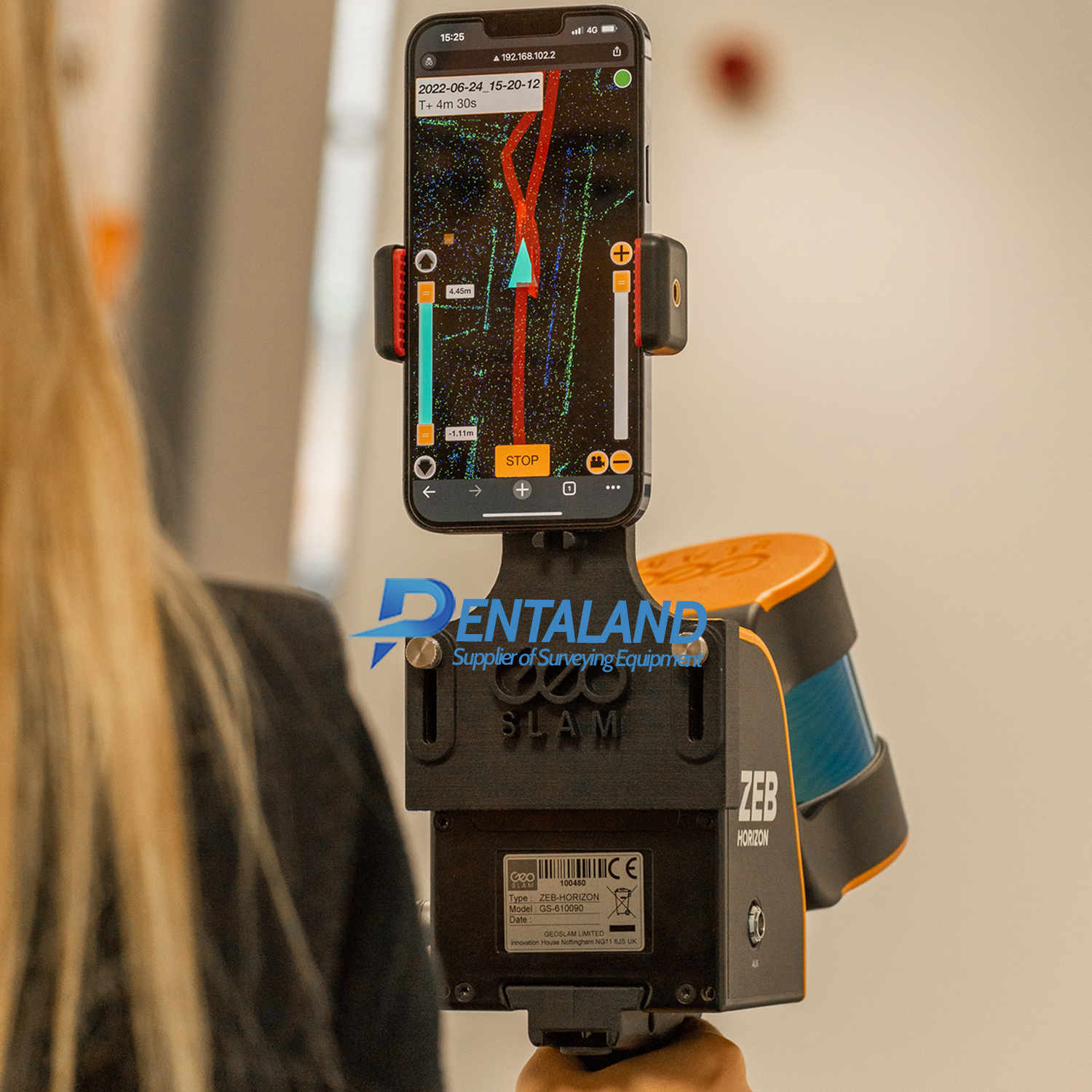
The new GeoSLAM ZEB Horizon RT 3D mobile mapping Scanner, the most versatile SLAM system now with a real-time data preview
Capture with confidence with the ZEB Horizon RT by visualising data in real-time.
CONNECT:
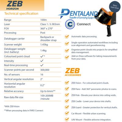
- Automatic data processing.
- Single-operation automated workflows including scan alignment and georeferencing.
- Organise point clouds into projects for simplified data management.
- Add on Draw software for taking measurements from your data
Product Includes:
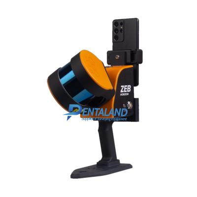
ZEB Horizon RT Scanner
ZEB Horizon data logger with shoulder strap (incl. 14.8V battery)
14.8V Battery Charger
ZEB Horizon main cable (1.5m length)
USB memory stick
Reference base
Shipped in a soft carry case
GeoSLAM Connect software (Not Included with Open Box Products)
36-month hardware warranty when a valid GeoSLAM Care package is in place
Speed
With 300,000 scanner points per second, it’s fast work scanning both simple and complex environments. You can carry out high-quality scans in less time.
Real-time
Gain real-time insight into your scan, see the areas you’ve covered (or missed) and the route you’ve taken before you leave site.
Accuracy
The ZEB Horizon provides 3D scanning with a survey grade relative accuracy of up to 6mm dependant on the environment. This gives you accurate scans and fine details.
Versatility
With a range of 100m, the ZEB Horizon is our most flexible 3D laser scanner yet. Use it outdoors, indoors or underground. Mount it to a drone, a backpack or a vehicle.
SPECIFICATIONS:
Range: 100m
FOV: 360° x 270°
Laser: Class 1 / λ 903nm
Processing: Post
Datalogger carrier: Backpack or shoulder strap
Scanner weight 1.45kg
Datalogger weight (incl. battery): 1.4kg
Colourised point cloud: YES
Intensity: YES
Real-time processing: YES
Scanner points per second: 300,000
No. of sensors: 16
Vertical angular resolution: 2°
Horizontal angular resolution: 0.2°
Relative accuracy: Up to 6mm**
Raw data file size: 100-200MB/ minute
OPTIONAL ZEB ACCESSORIES:
ZEB Vision - For colourised point clouds.
ZEB Pano - Add 360° panoramic photos to scans.
ZEB Pole - Elevate your device into ceiling voids.
ZEB Cradle - Lower your device into shafts.
ZEB Guard - Greater protection for vertical shafts.
Car Mount - Flexible urban scanning.
UAV Mount - Flexible airborne integration.
*With ZEB Vision
**When processing data in FARO Connect
Pentaland
Pentaland Surveying specialized in sale and service of surveying instrument and measuring equipment with more than 15 year experience. We supply a wide range of latest instruments, accessories and consumables for measuring, surveying applications and construction such as 3D Laser Scanner, Digital Templating System, GPS GNSS Systems, Ground Penetrating Radar, Laser Tracker, Phased Array Flaw Detector, Pre-Owned 3D Scanners, Robotic Total Stations, Thermal Imaging Camera, XRF Analyzers.
Categories
Manufacturer
© 2014 - 2026 Pentaland | All Rights Reserved
