

RESEPI Livox Avia Single Antenna Receiver Lidar
$12,300
Related Products
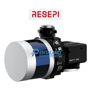
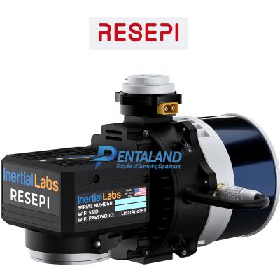
For sale the new RESEPI Livox Avia Single Antenna Receiver Lidar
The new Livox Avia Single Antenna Receiver Lidar Unit comes Full Kit with Camera
Product Includes:
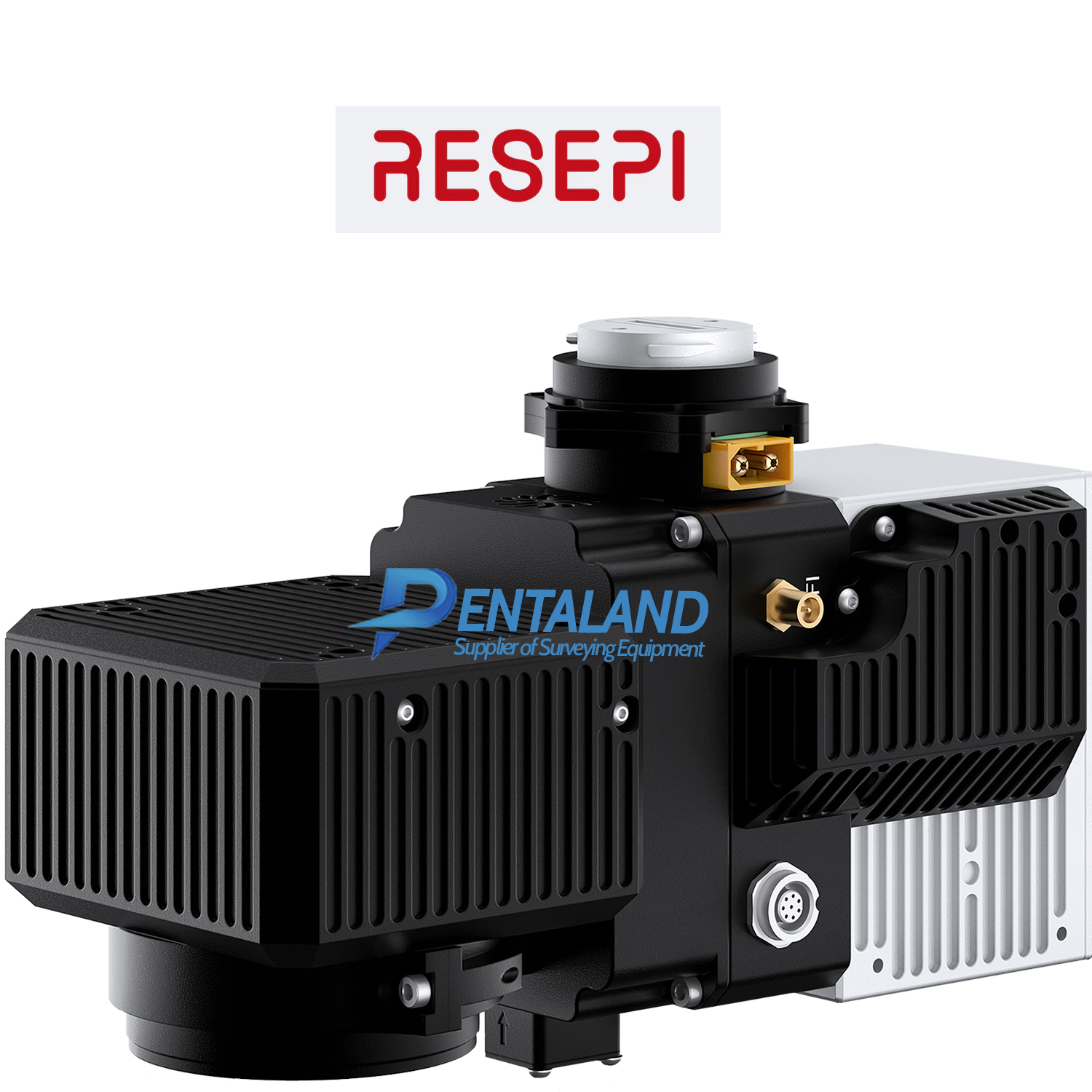
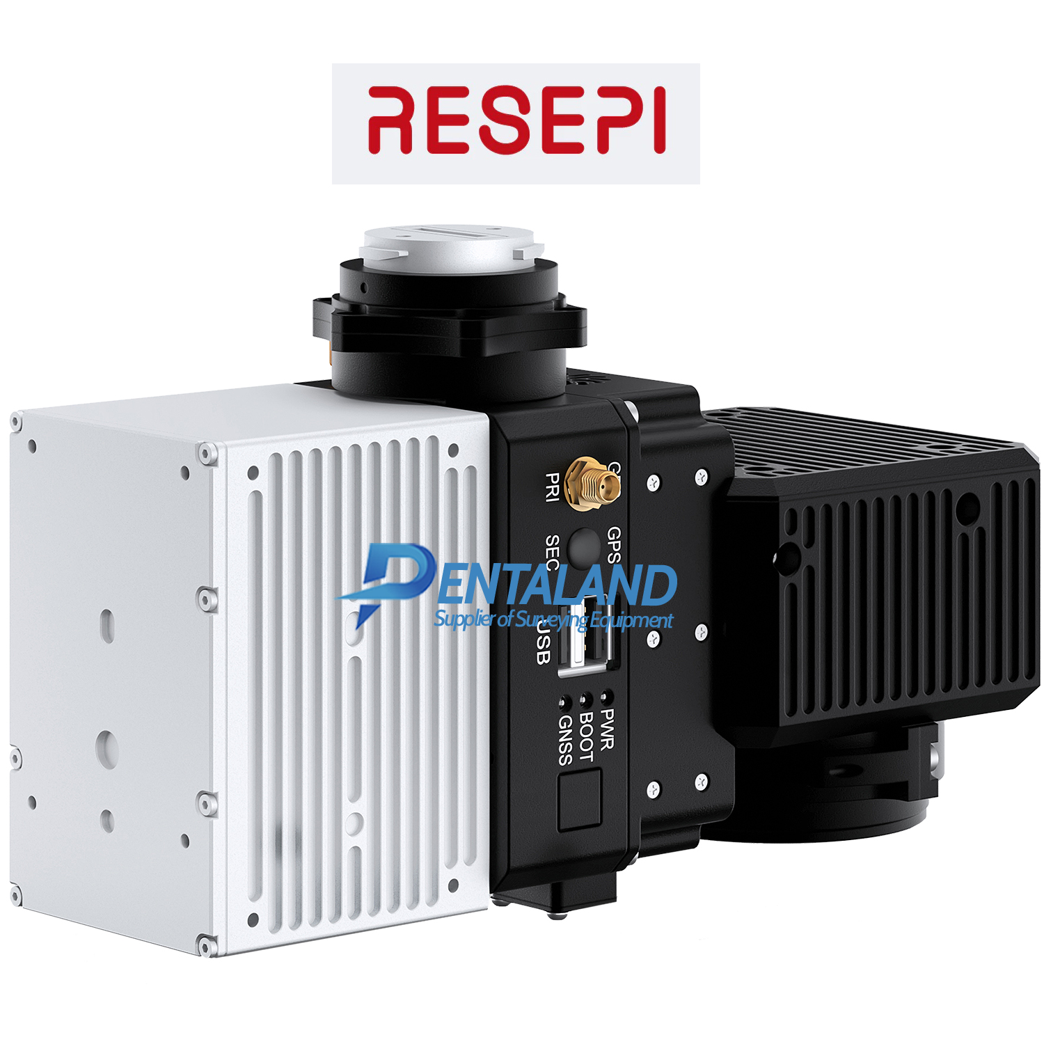
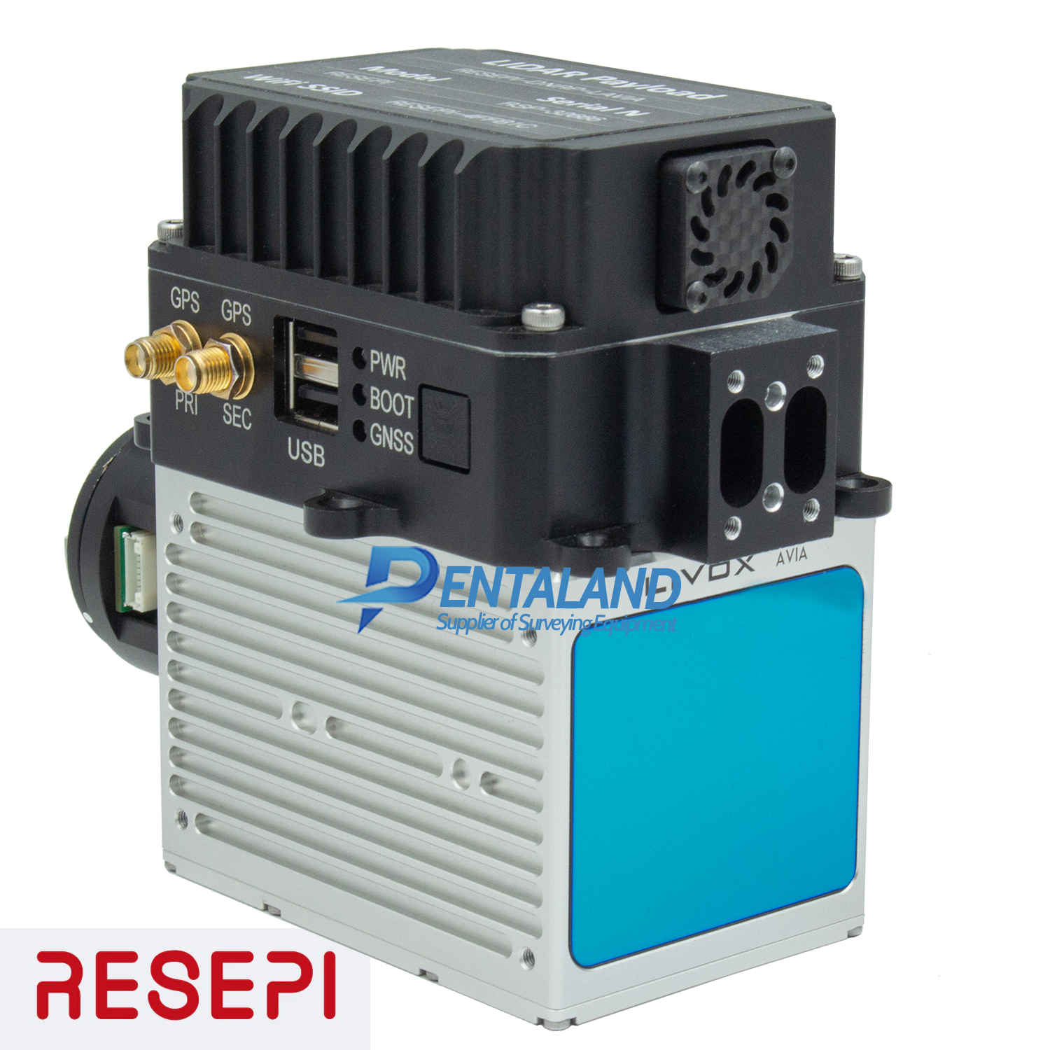
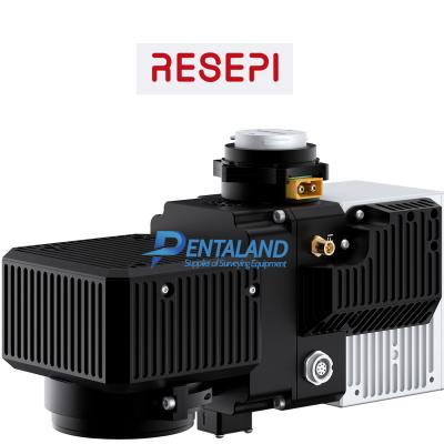
- Livox Avia Lidar unit
- Inertial Labs INS-B-OEM with Ublox Single-GNSS-Antenna Receiver
- Camera, lens, USB hub, wall plug and barrel adapter
- RESEPI Lidar PC Master Pro Data Processing Software Annual
- RESEPI Lidar Hard Case
Product Details:
RESEPI™ AVIA RESEPI™ (Remote Sensing Payload Instrument) is a sensor-fusion platform designed for accuracy-focused remote sensing applications. RESEPI utilizes a high-performance Inertial Labs INS (GPS-Aided Inertial Navigation System) with a tactical-grade IMU and a high-accuracy dual-antenna GNSS receiver, integrated with a Linux-based processing core and datalogging software. The platform also provides a WiFi interface, optional imaging module and external cellular modem for RTCM corrections. RESEPI can be operated by a single hardware button or from a wirelessly connected device via a simple web interface.
RESEPI Overview
LiDAR Scanning & Mapping Solution RESEPI equipped with AVIA LiDAR is the lightest configuration, coming in at below 1kg. This enables longer flight times and increases the selection of drone platforms ton include those with lower payload capacity. The narrow scan field of view concentrates laser measurements resulting in a higher ground point density. RESEPI AVIA is a compact, lightweight, and competitively priced scanning and mapping solution.
RESEPI AVIA RESEPI AVIA excels at surveying thin objects such as powerlines. Utility lines are long with a small diameter and can be hard for some lasers to track. AVIA’s high point density causes the lines to stand out and appear more clearly in point cloud data. Another great application is surveying long distances over large tracts of land such as airport runways or racetracks.
RESEPI AVIA can be flown at higher speeds and the narrow Field of View allows for preservation of point cloud density. Coupled with the lighter weight of the payload, available flight time is improved.
System Vertical Accuracy (5m/s @ 50m) +- 5cm
Recommended AGL 50-100m
Weight 1.24kg (with camera) .92kg (without camera)
Dimensions 20x 13 x 9.2cm
Max Flight Time (DJI M300) 35 minutes
External Storage 256GB USB Included
Pentaland
Pentaland Surveying specialized in sale and service of surveying instrument and measuring equipment with more than 15 year experience. We supply a wide range of latest instruments, accessories and consumables for measuring, surveying applications and construction such as 3D Laser Scanner, Digital Templating System, GPS GNSS Systems, Ground Penetrating Radar, Laser Tracker, Phased Array Flaw Detector, Pre-Owned 3D Scanners, Robotic Total Stations, Thermal Imaging Camera, XRF Analyzers.
Categories
Manufacturer
© 2014 - 2026 Pentaland | All Rights Reserved
