
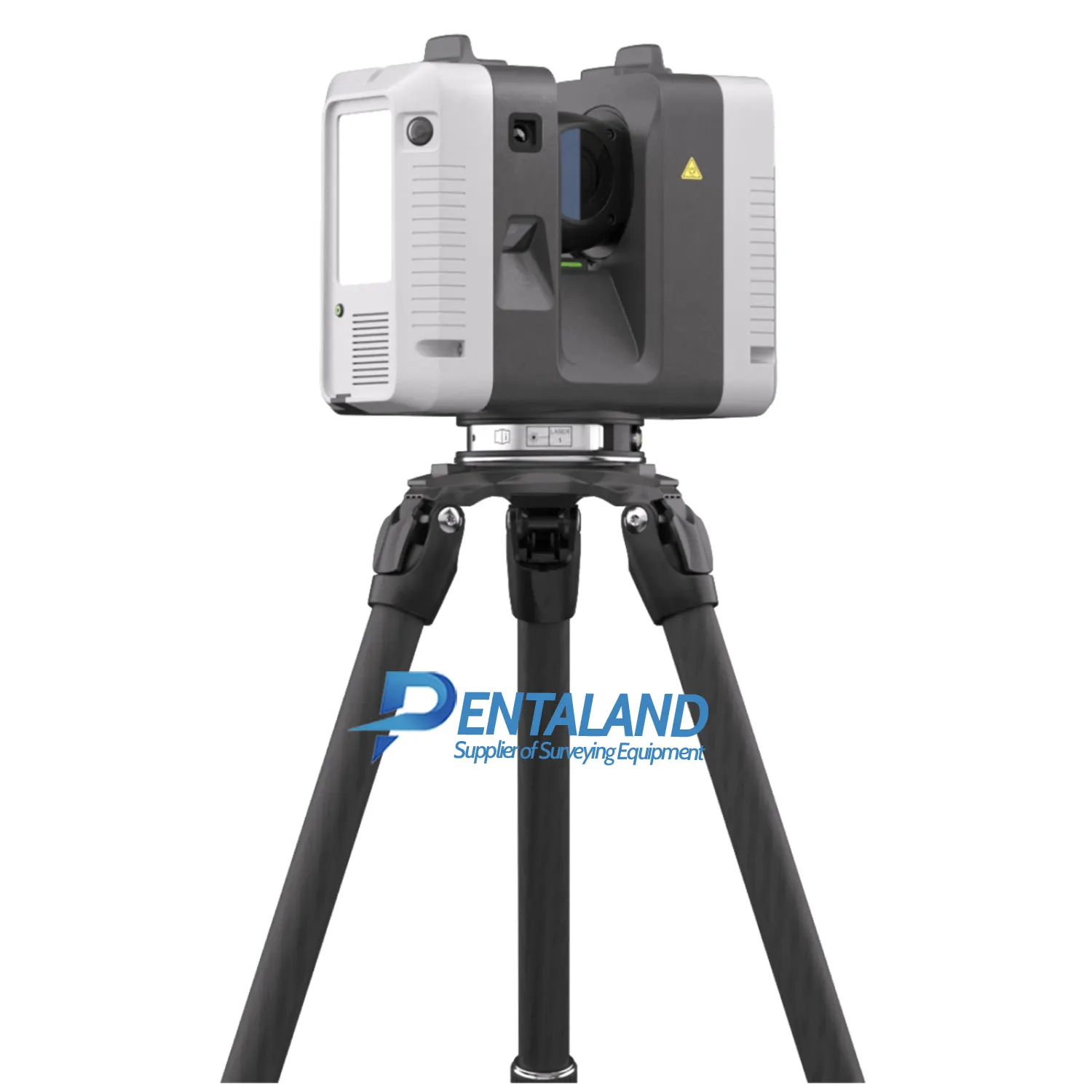
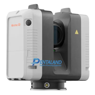


Artec Ray II 3D Scanner
$55,000
Related Products
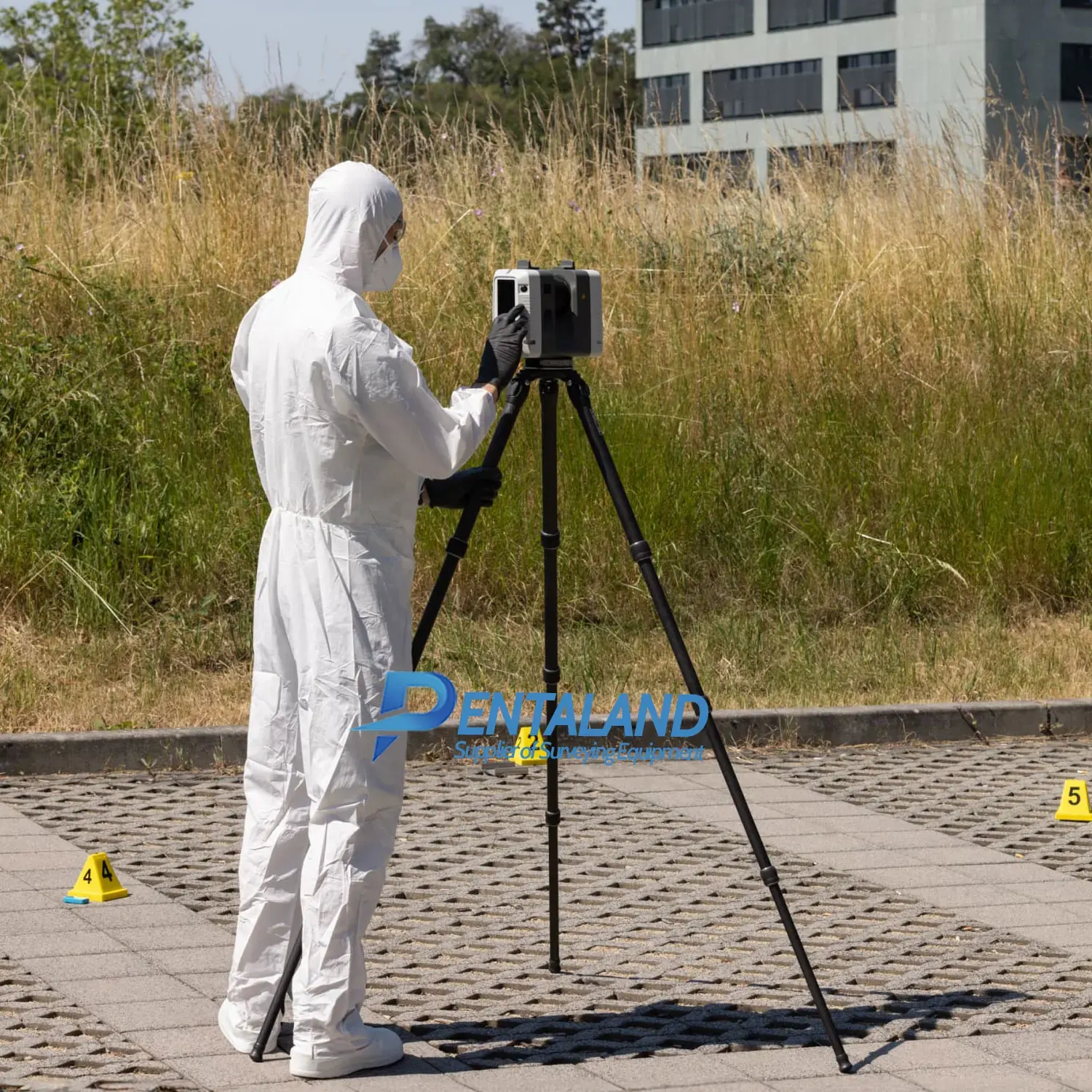
Sale new Artec Ray II with 1-year Artec warranty, the Ultimate Long-Range 3D Scanner for professional captures with high accuracy. The Artec Ray ll is a game-changer in the world of 3D scanning. This laser scanner for large objects is specifically designed to capture intricate details of large structures such as buildings, aircraft, ships, and wind turbines. With its advanced laser technology, the Artec Ray II delivers high-resolution 3D scans with remarkable speed and precision.
With the high-accuracy, long range, wireless Artec Ray II laser 3D scanner you can precisely and rapidly capture large to massive objects, scenes or areas, and from up to 130 m away. Expect 3D point accuracy that meets high professional standards and best-in-angular-class accuracy.
Package includes;
- Artec Ray II Laser Scanner
- Transportation container
- 4x Lithium-Ion Batteries
- Multi-charger, 4 slots
- USB Flash Drives, 256GB
- Tripod Adapter - allows the use of the scanner with almost any industrial tripod
- Quick Start Guide
- Calibration Certificate Silver - specifies the measurement standard deviation and includes a product specific summary of the relevant measurement values obtained, partly supplemented by measurement reports
- 1 Year warranty (extended up to 5 years)
- Artec 3D Lifetime Support - no need to stay on any customer care contract, 24/7 global technical assistance is available to every Artec 3D user for no charge
Unleashing the Power of 3D Scanning for Industrial Applications
Our Artec Ray II is not just a tool; it’s a solution. It offers long-range 3D scanning for large objects, making it an invaluable asset for industrial applications. Whether you’re conducting a building scan, aircraft inspection, ship survey, or wind turbine inspection, the Artec Ray II ensures you get the data you need to make informed decisions.
Preserving Heritage, Driving Innovation
The Artec Ray II is not just about industrial applications. It’s also a powerful tool for heritage preservation, product development, and reverse engineering. With its ability to capture intricate details, the Artec Ray II is helping to preserve our past while driving the innovations of the future.
Artec Ray II Product Specifications & Highlights
- Stationary 3D scanner for precise capture of large objects including buildings, ships, and aircraft
- Suitable for outdoor and indoor use with a range of 130m
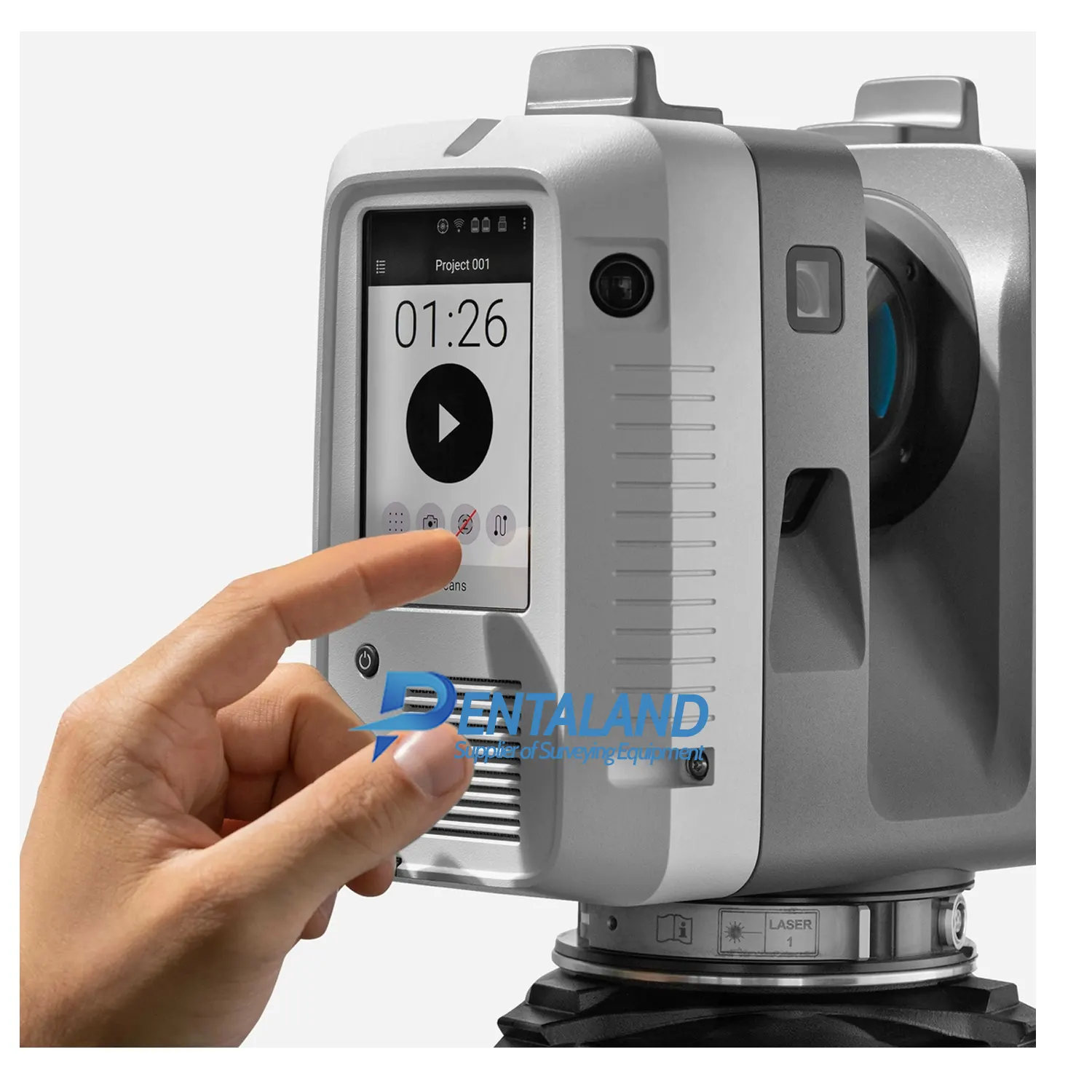
- Touchscreen control
- IP54 water and dust protection
- Extremely high-quality 3D scan at the sub-millimetre level
- 3 x 36MP cameras for high-quality colour capture
- Hassle-free post-processing in Artec Studio
Why Choose Central Scanning for Your 3D Scanning Needs?
We understand that choosing a 3D scanning solution is a significant decision. That’s why we’re committed to providing you with the information you need to make the right choice.
FAQS
What makes the Artec Ray II different from other 3D scanners?
The Artec Ray II offers long-range scanning capabilities, making it ideal for large objects. It’s also incredibly precise, delivering high-resolution 3D scans quickly and efficiently.
Can the Artec Ray II be used for building scanning and aircraft inspection?
Absolutely. The Artec Ray II is perfect for building scanning, aircraft inspection, ship surveying, and wind turbine inspection.
How can the Artec Ray II benefit my business?
The Artec Ray II can streamline your workflows, improve your data accuracy, and ultimately save you time and money.
| ARTEC RAY II TECHNICAL SPECIFICATIONS | |
| Accuracy & resolution | |
| 3D point accuracy | 1.9 mm @ 10 m 2.9 mm @ 20 m 5.3 mm @ 40 m |
| Angular accuracy | 18” (0.87 mm @ 10 m |
| Range accuracy | 1.0 mm + 10 ppm |
| Resolution | 3 user selectable settings: 3 / 6 / 12 mm @ 10 m |
| Range noise | 0.4 mm @ 10 m 0.5 mm @ 20 m |
| Field of view & range | |
| Field of view | 360° (horizontal) / 300° (vertical) |
| Range | 0.5 — 130 m |
| Speed | |
| 3D capture rate | Up to 2,000,000 pts/sec |
| Scanning time without texture @ 10 m | 1.7 min @ 3mm resolution 0.85 min @ 6mm resolution 0.4 min @ 12mm resolution |
| Scanning time with texture @ 10 m | 2.7 min @ 3mm resolution 1.9 min @ 6mm resolution 1.4 min @ 12 mm resolution |
| Color capture | |
| Camera | 36 MP 3-camera system captures 432 MPx raw data for calibrated 360° × 300° spherical image |
| HDR | Automatic, 5 brackets |
| Operation | |
| On scanner | Touchscreen control with finger touch, full color WVGA graphic display 480 × 800 pixels |
| Mobile devices | Artec Remote app for iOS and Android tablets and smartphones including: • Remote control of scan functions • Settings selection • Launch scanning |
| Algorithms | |
| Real time registration | Automatic point cloud alignment based on real time tracking of scanner movement between setups based on Visual Inertial System (VIS) by video enhanced inertial measurement unit |
| Automatic removal of moving objects | Delete captured data of moving objects using Double Scan |
| Check & Adjust | Field procedure for targetless checking of angular parameters |
| Navigation sensors | |
| Visual Inertial Systems | Video enhanced inertial measuring system to track movement of the scanner position relative to the previous setup in real time |
| Tilt | IMU based, Accuracy: 18” (for upright and upside down setups with +/- 10° inclination |
| Geolocation sensors | Altimeter, Compass, Global Navigation Satellite System |
| Interfaces | |
| Wireless | Integrated wireless LAN (802.11 b/g/n |
| Data storage | AS256, 256 GB exchangeable USB 3.0 flash drive |
| Hardware specifications | |
| Scanning technology | Time of flight enhanced by Waveform Digitising (WFD) technology |
| Laser clas | 1 (in accordance with IEC 60825-1:2014), 1550 nm (invisible) |
| Dimensions | 120 mm × 240 mm × 230 mm / 4.7” × 9.4” × 9.1” |
| Weight | 5.35 kg / 11.7 lbs, nominal (without batteries) |
| Mounting mechanism | Quick mounting on 5/8” stub on lightweight carbon tripod or tripod adapter |
| Power | |
| Internal battery | 2 × AEB364 internal, rechargeable Li-Ion batteries Duration: Typically up to 4 hours Weight: 340 gr. per battery |
| External | GEV282 AC adapter |
| Environmental | |
| Operating temperature | -5° to +40°C |
| Storage temperature | -40° to +70°C |
| Operating low temperatures | -10° to +40°C |
| Dust/Humidity | Solid particle/liquid ingress protection IP54 (IEC 60529) |
Pentaland
Pentaland Surveying specialized in sale and service of surveying instrument and measuring equipment with more than 15 year experience. We supply a wide range of latest instruments, accessories and consumables for measuring, surveying applications and construction such as 3D Laser Scanner, Digital Templating System, GPS GNSS Systems, Ground Penetrating Radar, Laser Tracker, Phased Array Flaw Detector, Pre-Owned 3D Scanners, Robotic Total Stations, Thermal Imaging Camera, XRF Analyzers.
Categories
Manufacturer
© 2014 - 2026 Pentaland | All Rights Reserved
