


Used Leica BLK360 G2 Imaging 3D Scanning
$10,400
Related Products
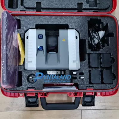
Buy Demo Used Leica BLK360 G2 Imaging 3D Scanning with Cyclone REGISTER 360 (BLK Edition) software License, VIS Scan Alignment System, Ready to go and calibrated by Leica authorized, 12 month Leica extension warranty
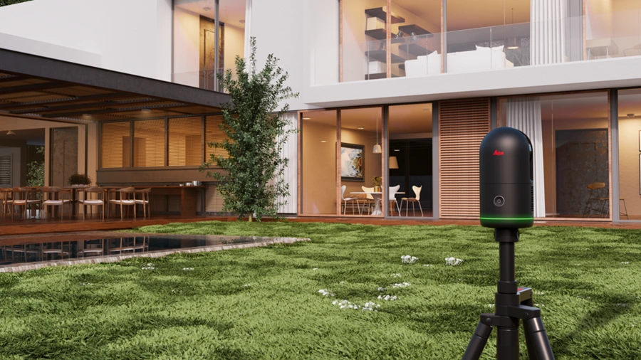
LEICA BLK 360 G2 3D Laser Scanner - Small, Fast, the ideal companion for efficient measurements
Features:
High-resolution image capture
Precise measurements with advanced laser technology
Ease of use with an intuitive interface
Optimal portability for use on various construction sites
Applications: Ideal for surveyors, architects, design offices, and building engineers
Why Choose the Leica BLK 360 G2?
The Leica BLK 360 G2 stands out for its precision and image quality, essential for detailed surveys and 3D modeling. Its easy portability and intuitive user interface make it ideal for everyday use, both indoors and outdoors.
Data Acquisition and Data Transfer:
- Turn on the tablet.
- Press the button on your BLK360 G2 scanner to turn it on. The Cyclone Field 360 interface will then guide you through the scanning process.
- To begin scanning, go to ”New Scan” on the tablet, then customize your scan settings.
- As the BLK360 G2 scans, images and scan data are transmitted to the mobile app in real time and automatically saved in a single point cloud project.
- A complete 360° scan can be completed in less than 2 minutes.
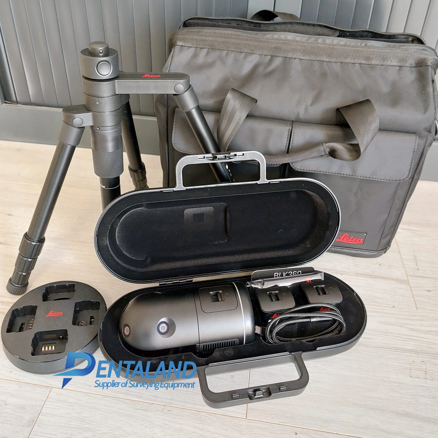
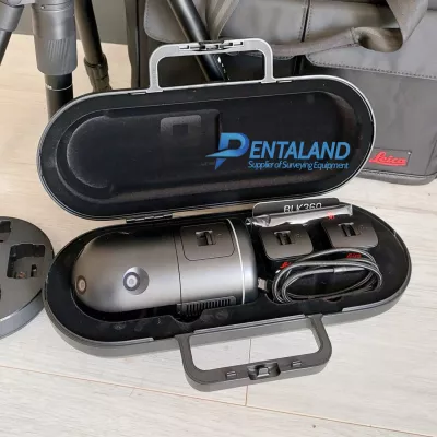
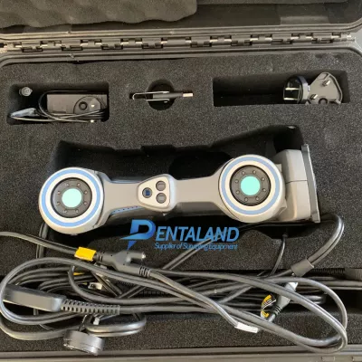
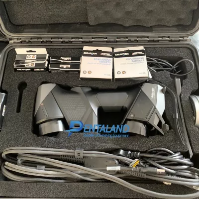
Leica BLK360 G2 Imaging 3D Scanning Includes:
- BLK360 G2
- 3 batteries
- 1 multi-charger
- 1 tripod
- 1 protective case
- 1 carrying bag
- 1 USB-C cable
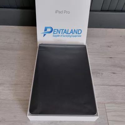
- 1 iPad PRO (BLK live app + export of a single scan in E57 format)
- Leica Cyclone REGISTER 360 (BLK Edition) (1yr)
- Condition: Nearly new, used once
Key Features
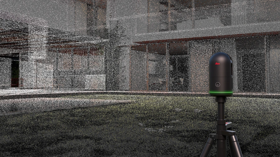
- Immersive HDR imaging
The BLK360's 4-camera system captures high dynamic range (HDR) spherical images, providing greater dynamic range for immersive photospheres and coloured point clouds.
Four 13-megapixel cameras capture the scene in high quality, and 5-bracket HDR imaging captures the detail in challenging lighting conditions and environments.

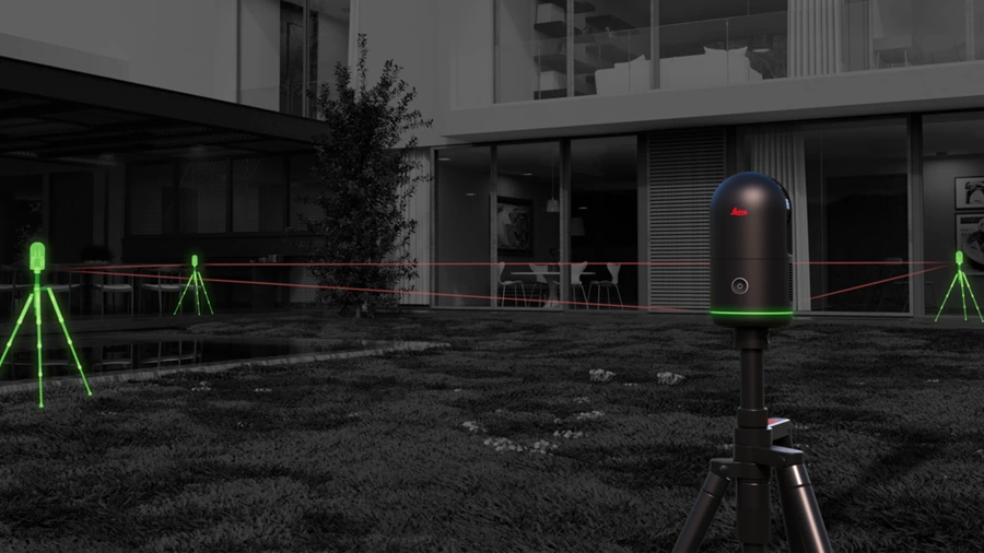
- VIS Scan Alignment System
Leica Geosystems' exclusive Visual Inertial System (VIS) technology is now built into the new BLK360 G2 to automatically combine your scans.
Each scan you take is combined with your previous scan in the field. You'll spend less time aligning data and more time producing valuable results.
- Ultra-fast Scanning
Building on the award-winning technology of the BLK360 G1, the new BLK360 has been optimised to collect data faster than ever before.
The integrated LiDAR sensor in the new BLK360 captures point clouds at a rate of 680,000 points per second and completes a scan with spherical images in 20 seconds.
- High-Speed Data Transfer
Enjoy real-time data synchronisation between your devices with the BLK360's built-in wireless connection, then transfer data with speed and stability via WiFI or its USB-C port.
![]()
With unprecedented, best-in-class scanning speed, the BLK360 G2 makes you faster.
Realistic Capture
Speed through construction sites with fast scanning that doesn't compromise on quality. Your work is faster, your job is easier and you get the data you need, when you need it.
Extremely Fast Scanning
A supercharged, next-generation imaging laser scanner, the BLK360 captures a full scan with spherical images in just twenty seconds - over four times faster than the BLK360 G1.
General
| Imaging Scanner | 3D scanner with integrated high-speed HDR spherical imaging system and Visual Inertial System (VIS) for real-time pre-registration |
Design & Physical
| Housing | Black Anodized Aluminum |
| Dimensions | Height:155 mm Diameter:80 mm |
| Weight | 0.75 kg (0.85 kg incl. battery) |
| Transport cover | GVP739 Transportation cover |
| Mounting mechanism | Button-press quick release |
Operation
| Stand-alone operation | One-button operation |
| Mobile devices | BLK Live app for IOS and Android smartphones Leica Cyclone FIELD 360 app for iOS and Android tablet computers and smartphones |
| Wireless communication | Integrated wireless LAN (802.11 b/g/n) |
| Internal memory | Storage for up to 1500 setups |
| Instrument orientation | Upright and upside down |
Power
| Battery type | Internal, rechargeable Li-lon battery (Leica GEB825) |
| Capacity | Up to 70 setups per battery |
Scanning
| Distance measurement system | High speed time of flight enhanced by Waveform Digitizing (WFD) technology |
| Laser class | 1 (in accordance with IEC 60825-1:2014) |
| Wavelength | 830 nm |
| Field of view | 360° (horizontal) / 270° (vertical) |
| Range* | min. 0.5 m - up to 45 m |
| Point measurement rate | Up to 680.000 pts/ sec |
| Measurement modes | 4 user selectable resolution settings (6/12/25/50 mm @ 10 m) |
Imaging
| Camera system | 13 Mpixel 4-camera system captures 104 Mpx raw data for calibrated 360° x 270° spherical image |
| Speed | < 8 sec. for full spherical LDR image at any light conditions <20 sec. for full spherical 5-brackets HDR image at any light conditions |
| Image modes | - Auto-exposed LDR - 5-brackets HDR - Off - scanning only |
Performance
| Data acquisition | < 20 sec. for complete full dome scan and spherical LDR image at 50 mm @ 10 m resolution with auto-matic tilt measurements |
| 3D point accuracy* | 4mm @ 10 m |
| Real time pre-registration | Automatic point cloud alignment based on real time tracking of scanner movement between setups based on Visual Inertial System (VIS) by video-enhanced inertial measurement unit |
Environmental
| Robustness | Designed for indoor and outdoor use |
| Operating temperature | 0° C to + 40 ° C |
| Dust / Humidity | Solid particle/ liquid ingress protection IP54 (IEC 60529) |
Data Processing
| Data transfer | Wireless and USB 3.0 |
| Desktop software | Leica Cyclone REGISTER 360 and Cyclone REGISTER 360 (BLK Edition) |
| Cloud software | HxDR Digital Reality: Cloud-based digital reality platform |
Pentaland
Pentaland Surveying specialized in sale and service of surveying instrument and measuring equipment with more than 15 year experience. We supply a wide range of latest instruments, accessories and consumables for measuring, surveying applications and construction such as 3D Laser Scanner, Digital Templating System, GPS GNSS Systems, Ground Penetrating Radar, Laser Tracker, Phased Array Flaw Detector, Pre-Owned 3D Scanners, Robotic Total Stations, Thermal Imaging Camera, XRF Analyzers.
Categories
Manufacturer
© 2014 - 2026 Pentaland | All Rights Reserved
