

GEOSLAM Zeb Revo RT 3D mobile mapping
$11,500
Related Products
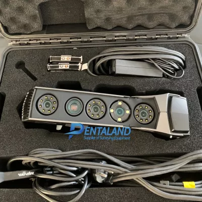
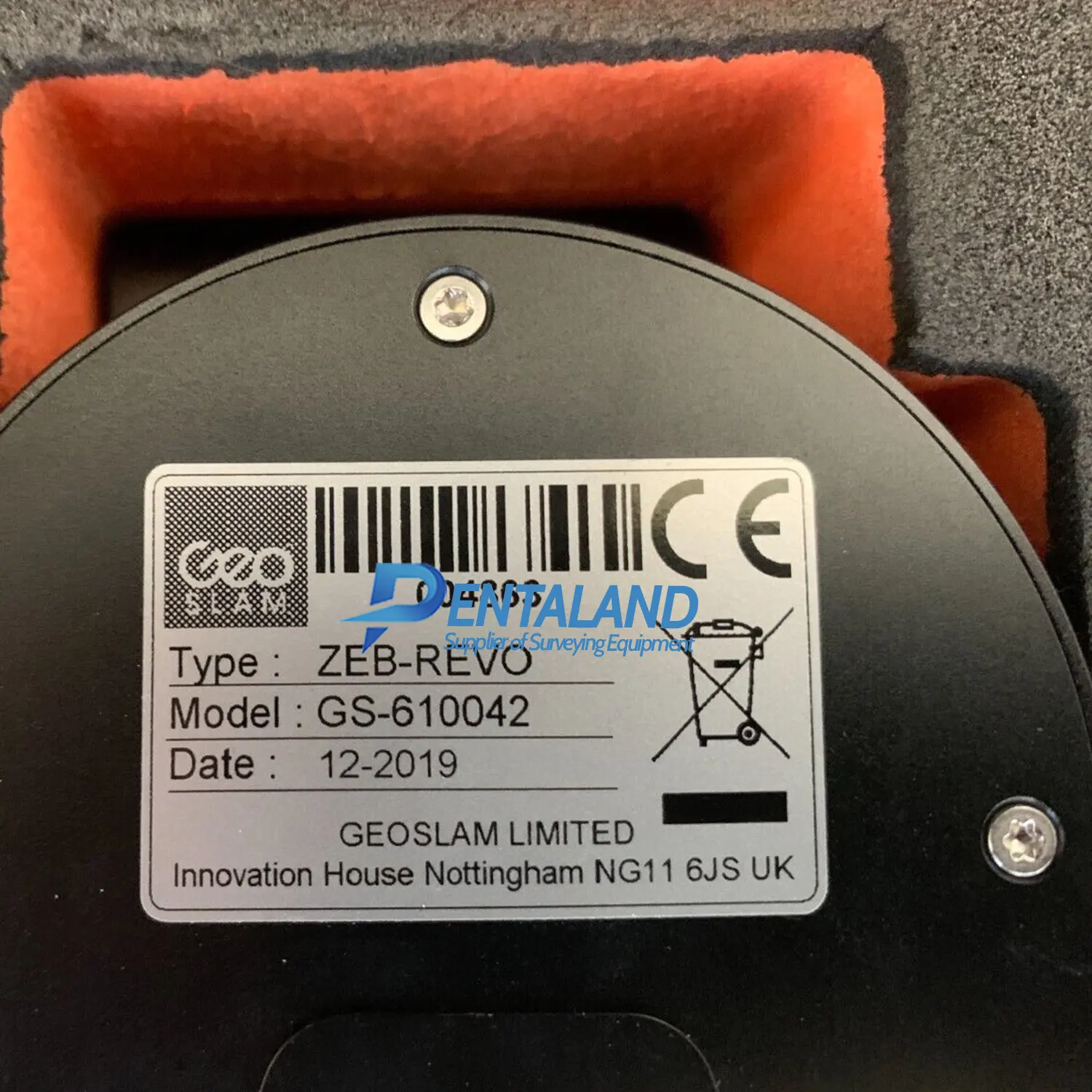
Used GEOSLAM Zeb Revo RT 3D mobile mapping Scanner for sale with HUB and DRAW starter software License, fully upgrade and calibrated by Geoslam authorized, 1 year Geoslam extension warranty and 30-day money back guarantee.
This GEOSLAM Zeb Revo RT Used for normal job, has been carefully inspected and is in very good condition., this mobile mapping scanner regularly fully upgrade and calibrated by GEOSLAM authorized to be ready to working and works flawlessly with GEOSLAM working standards.
This GEOSLAM Zeb Revo RT sale covering with 1 year GEOSLAM extension warranty for both parts and labour and 30-day money back guarantee.
The GEOSLAM Zeb Revo RT 3D mobile mapping Scanner, Handheld, lightweight and easy to use, allows you to rapidly build highly accurate 3D models within minutes, while on the move.
The complete solution that allows you to start mapping the world around you today with any WiFi enabled device. Scan, visualize and process simultaneously, as you walk.
- 100m Range View data in real time
- Indoors and Outdoors Mounting options
- Go anywhereGo anywhere
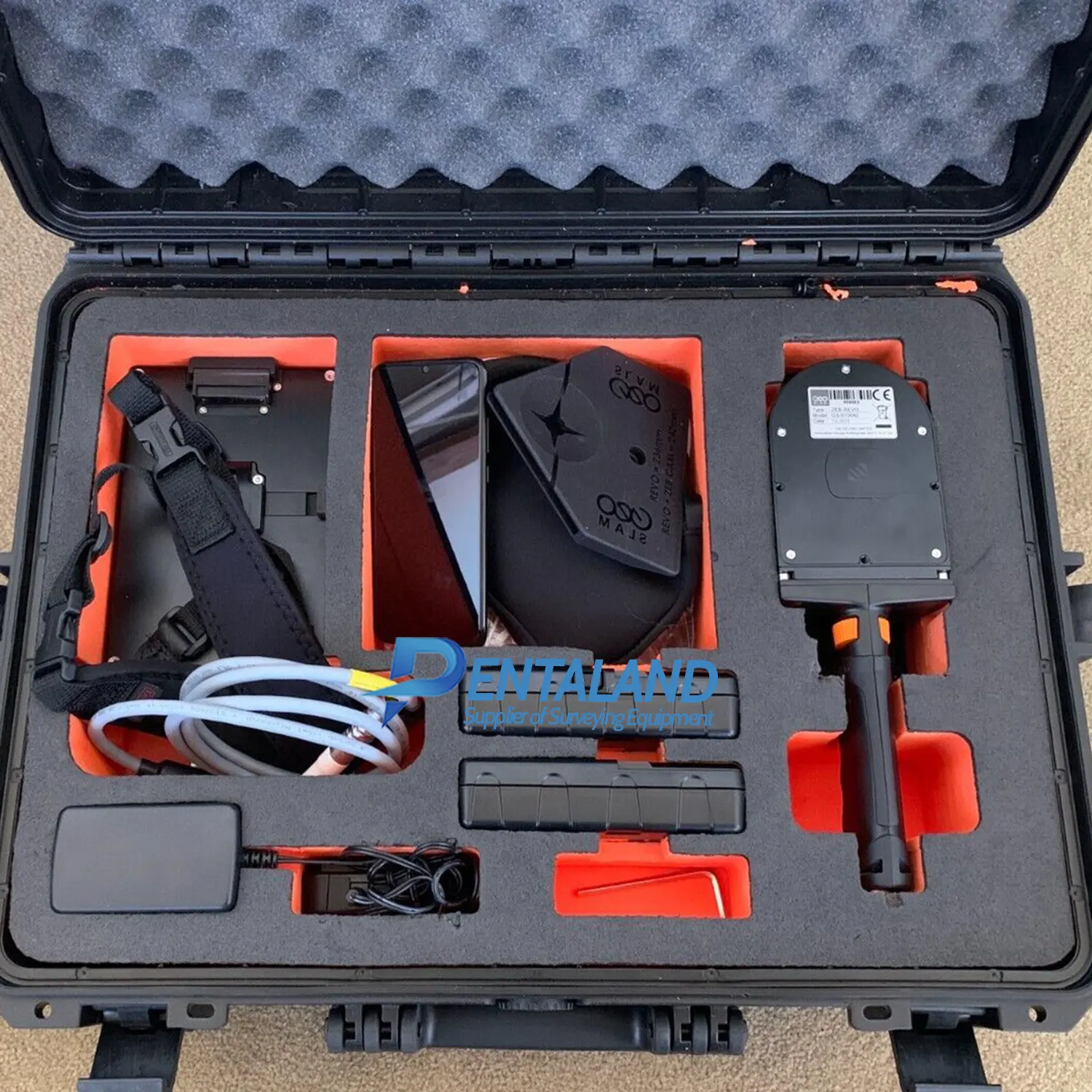
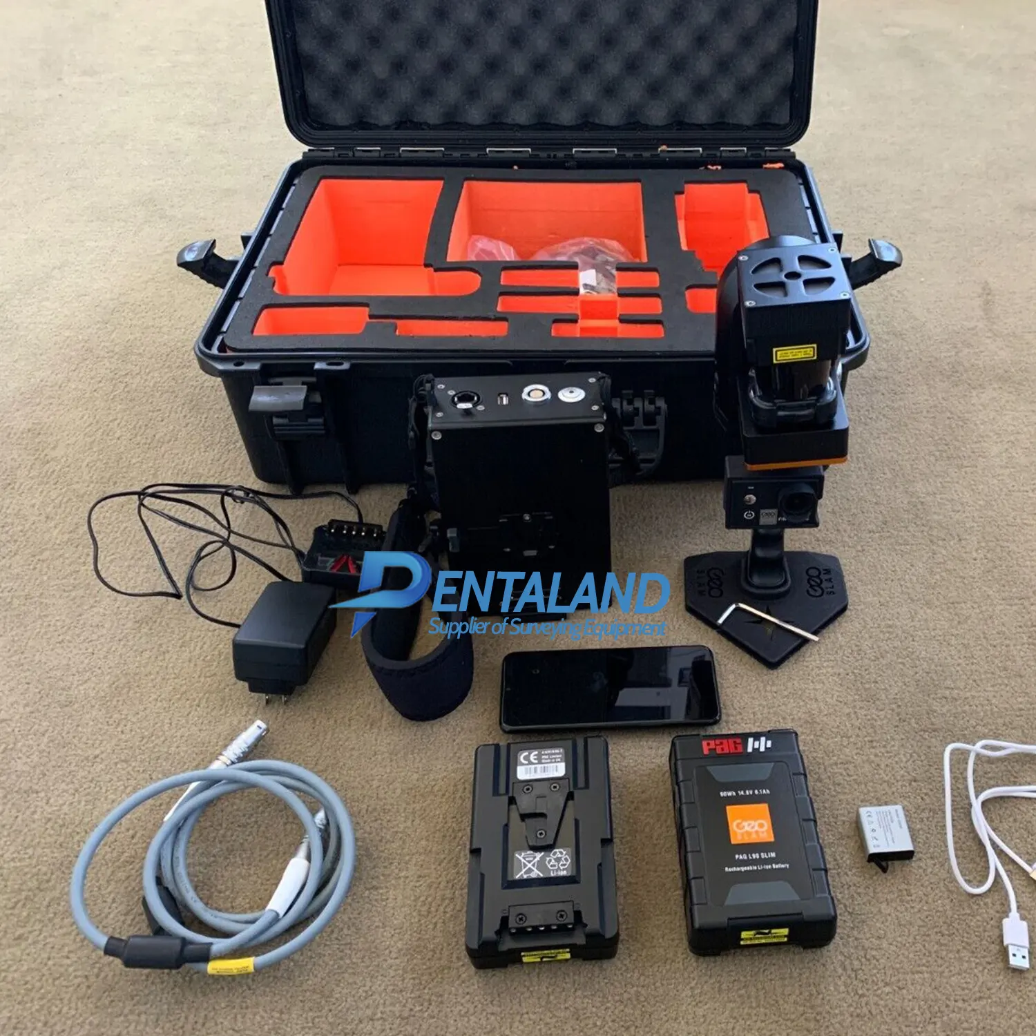
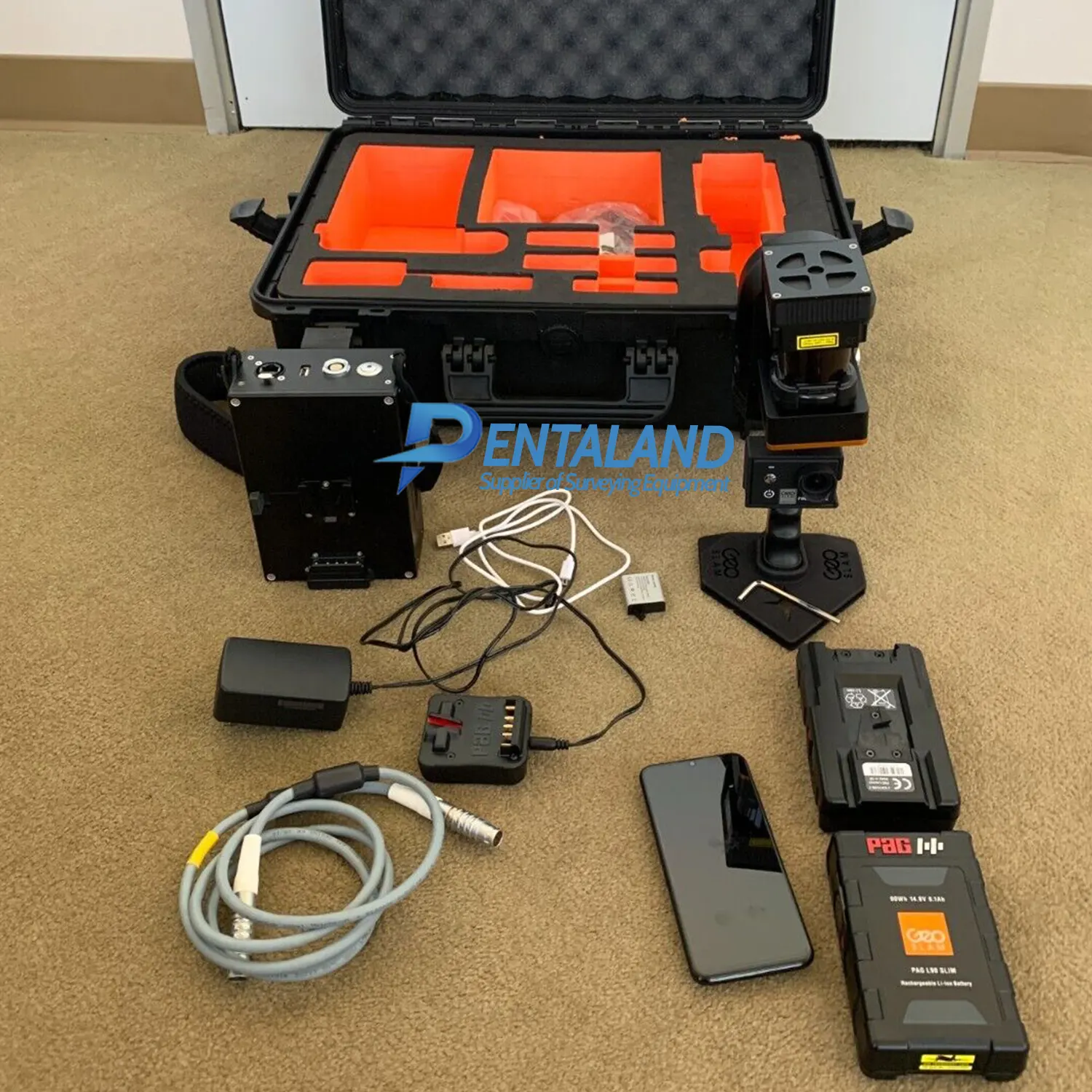
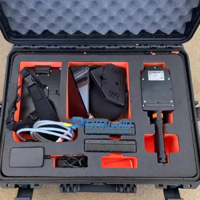
Product Includes:
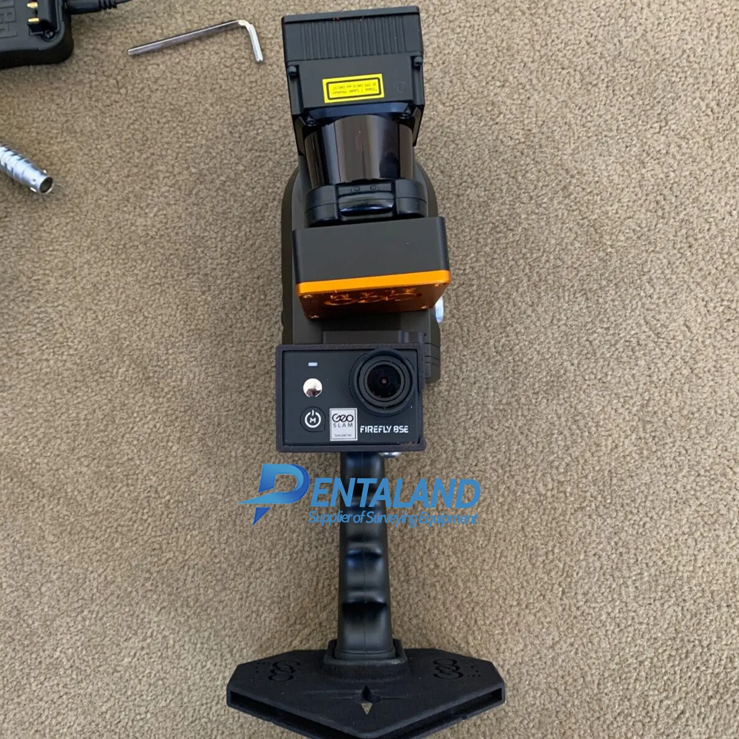
1x GeoSLAM ZEB REVO 3D Laser Scanner
1x ZEB CAM camera
1x GeoSLAM ZEB REVO RT datalogger
2x Rechargeable batteries
Interface cables
Charger
Hard case for transport
1x GeoSLAM HUB license
1x GeoSLAM DRAW starter license
12-month hardware warranty
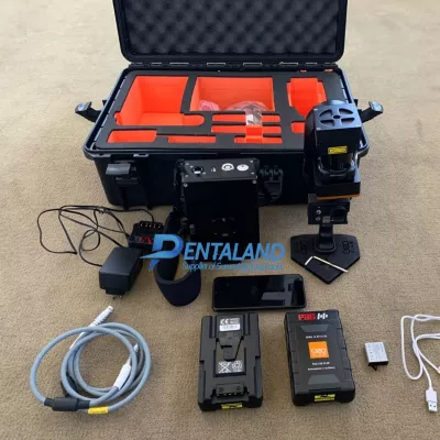
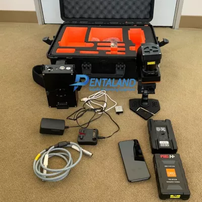
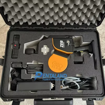
Accessories Includes:
Spare 14.8V battery, 14.8V battery charger
Extendable Pole, Reference Plate
Spherical Targets
3 and 5 meter cables
REVO Cradle
The brand new new GEOSLAM Zeb Revo RT also available for sale at our shop
Powered by the smartest SLAM
With one button operation, you’ll be up and running fast – capturing survey grade data in minutes.
Process a pointcloud quickly using our intelligent point cloud processing platform GeoSLAM Connect.
GeoSLAM data is compatible with software that works for you with universal file formats (LAZ/LAS/PLY/TXT/e57).
GEOSLAM ZEB Revo RT – One tool. So many ways to use it.
Cradle AccessoriesZEB Pano – Use the ZEB Pano for adding 360° imagery for indoor property surveys and real estate applications.
Pole AccessoriesZEB Cam – For colorized point cloud and referenced photos.
Drone AccessoriesCradle & Pole – Elevate or lower your ZEB Revo RT into difficult spaces like ceiling voids and manholes.
Remote AccessRemote Access – Real time remote data capture for robotic navigation via an API control.
Software that works for you.
Data from the ZEB Revo RT can be exported from GeoSLAM Hub in all industry standard file formats.
Import into your preferred CAD program or mine planning software, the ZEB Revo RT is as flexible as you are.
Why not try GeoSLAM Connect, plus Draw which allows users to quickly extract floorplans and sections from point cloud data.
ZEB Revo RT
Real-time processing which means you can visualize the scan as you move. Has a range of 30m and IP51 rating. Used mostly for scanning indoors and utilized for applications such as construction/BIM or creating floorplans.
Features:
scans & processes simultaneously, as you walk
handheld
lightweight
easy to use
no need for GNSS
1-3 cm accuracy
industry-standard file formats
Data capture is as simple as “walk and scan.” Map a 3-story building in just 30 minutes to an accuracy level of 15mm or scan, view and export up to 10,000 m2 (105,000 sq. ft.) in under 1 hour.
Join our customers as they measure building plans 10 times faster than traditional tools, deliver BIM models earlier than expected and experience project cost savings of up to two thirds.
This solution allows customers to expand their range and scope of services by taking on projects that would otherwise have proved too difficult or time-consuming using traditional techniques.
- Captures data up to 8X faster than with terrestrial scanners
- Saves time due to a fully automatic registration process
- Simple and efficient 2D plan generation
- No point cloud conversion for CAD required
Pentaland
Pentaland Surveying specialized in sale and service of surveying instrument and measuring equipment with more than 15 year experience. We supply a wide range of latest instruments, accessories and consumables for measuring, surveying applications and construction such as 3D Laser Scanner, Digital Templating System, GPS GNSS Systems, Ground Penetrating Radar, Laser Tracker, Phased Array Flaw Detector, Pre-Owned 3D Scanners, Robotic Total Stations, Thermal Imaging Camera, XRF Analyzers.
Categories
Manufacturer
© 2014 - 2026 Pentaland | All Rights Reserved
